
Review of Regional Weather for September 2021
1. Overview
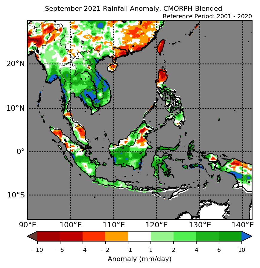
1.1 During September 2021, there was above-average rainfall recorded over much of the ASEAN region (Figure 1). The exceptions were northern Sumatra and northern Philippines, and also parts of northern Myanmar, Peninsular Malaysia, Borneo, and Papua, which received a mix of below- to near-average rainfall. The largest positive anomalies (wetter conditions) were recorded over eastern Mainland Southeast Asia (due to Tropical Storm Conson and Tropical Storm Dianmu which made landfall in early-September and late-September respectively) and southern Myanmar for both satellite-derived rainfall estimates datasets (GSMaP-NRT and CMORPH-Blended), with GSMaP-NRT also recording larger anomalies over eastern Borneo, northern and eastern Sulawesi, and Maluku Islands.
1.2 The observed rainfall anomaly pattern of above-average rainfall for much of the ASEAN region is broadly consistent with the predictions from the subseasonal weather outlooks for September 2021 (23 August – 5 September, 6 – 19 September and 20 September – 3 October).

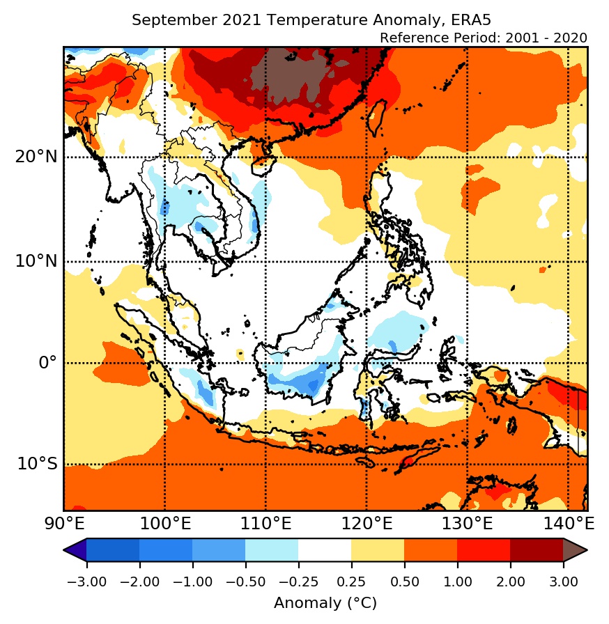
1.3 Most of the ASEAN region experienced below to near-average temperatures during September 2021 (Figure 2), in line with the wetter conditions recorded. The exceptions were warmer-than-average temperatures recorded over the southeastern Maritime Continent and northern Myanmar.
2. Climate Drivers
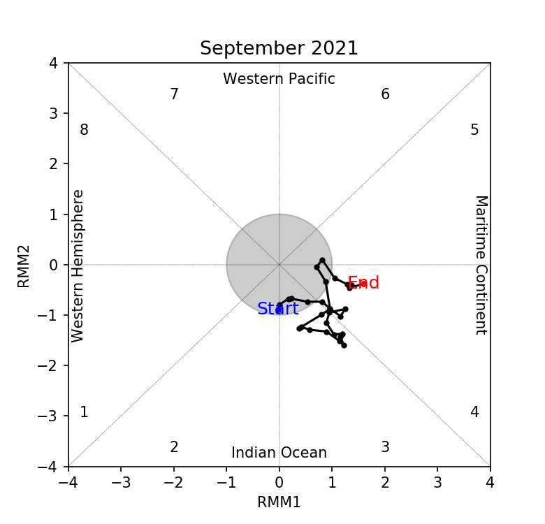
2.1 The Madden-Julian Oscillation (MJO, Figure 3) signal over the Indian Ocean (Phase 3) appeared incoherent for most of September 2021 due to interference with other tropical waves. In the last week of September, an MJO signal emerged over the Maritime Continent (Phase 4). Phase 3 tends to bring wetter conditions to western Maritime Continent while Phase 4 tends to bring wetter conditions to much of the region at this time of the year.
2.2 In September, there have been some signs of La Niña-like conditions developing in the tropical Pacific. However, atmospheric indicators (OLR and wind anomalies) have not shown consistent La Niña-like conditions yet. A weak negative Indian Ocean Dipole (IOD) was present and at the seasonal timescale, negative IOD events tend to bring wetter conditions to the southern Maritime Continent.